Feature
SAR 1.0 : Basics of Radar Imaging
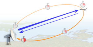
Radar stands for Radio Detection and Ranging. A radar measures the range or distance to an object by transmitting an electromagnetic signal to an object and receiving the echo reflected by the object. Since electromagnetic waves travels at the speed