Feature
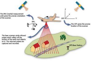
Introduction to LiDAR remote sensing
Learning Objectives¶ In this tutorial, we will learn how to work with lidar derived raster product that represent topography and snow depth. The objectives include: Understanding the basic concept of lidar remote sensing Deriving snow products from lidar DEMs differencing