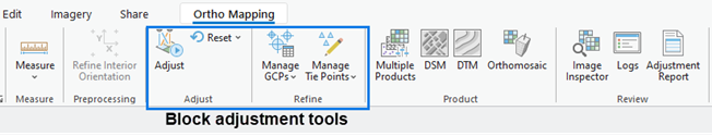
After creating the Ortho mapping workspace, we have to perform block adjustment using the tools in the Adjust and Refine groups.
A block adjustment is a technique used in photogrammetry in which a transformation is computed for an area (a block) based on the photogrammetric relationship between overlapping images, ground control points (GCPs), a camera model, and elevation data.
Follow the video or the instruction below to perform block adjustment
On the Ortho Mapping tab, in the Adjust group, click Adjust. In the Adjust window, under Block Adjustment ,uncheck Quick Adjust at Coarse Resolution Only to make the adjustment more robust. If you want a quick solution, you can check this. Check the camera calibration options to calculate the lens distortion parameters during adjustment. You can uncheck these option for high-quality camera with know calibration. Blunder Point Threshold sets the error limits for points to be used in computing the adjustment. Set this to 5 or as desired. Check the Use Orientations from Metadata. This reduces the adjustment duration using the exterior orientation information embedded in the image EXIF as initial values. Tie Point Matching defines the resolution at which tie points are calculated. Larger values allow the adjustment to run more quickly. For Image Location Accuracy, choose High from the drop-down menu. Click Run. The block adjustment will take a bit of time to finish.
After the adjustment is completed, the logs displays statistical information such as the mean reprojection error (in pixels), which signifies the accuracy of adjustment, the number of images processed, and the number of tie points generated (more than 600 points).
At this point, the relative accuracy of the images has been improved and we can generate products, But before that, we need to also improve the absolute accuracy. To do this, Ground Control Points must be added to the block. So let’s do that following the video or instruction below.
Go to the Reality Mapping tab and click Manage GCPs (in the Refine group). The GCP Manager window appears. In the GCP Manager window, click the Import GCPs button. The Import GCPs window opens. Browse to the folder where you save the GCP file and select. click Ok. Under Set GCP Spatial Reference, click the little globe button and set the spatial reference of your GCPs accordingly…. click OK. If you want to transform your reference system, you can do that under geographic transformation section. Map the GCP fields accordingly under Field Mappings. Click OK to import the GCPs. The imported GCPs are listed in the GCP Manager window, and the relative locations are displayed in the 2D map view with a red position indicator. The control point layer is also updated accordingly. Now let’s add tie points to the GCPs. Click each GCPs in the GCP manager window. A small window below will show images containing the selected GCPs. The photos are listed on the ease of locating the GCPs so the first are almost always the easiest to use. click the Add GCP or Tie Point button in the GCP Manager window and add a tie point in the image viewer for each image. The tie points for other images are automatically calculated by the image matching algorithm when possible, indicated by a blue cross next to the image ID. Review each tie point for accuracy. If the tie point is not automatically identified, add the tie point manually by selecting the appropriate location in the image. After each GCP has been added and measured with tie points, select one of the GCPs, and change it to a check point. This provides a measure of the absolute accuracy of the adjustment, as check points are not used in the adjustment process. After adding GCPs and check points, click Adjust to run the adjustment again to incorporate these points. It will a while to finish the adjustment again.
Once the block adjustment is complete, 2D and 3D imagery products can be generated using the tools in the Product group on the Reality Mapping tab. We will do this in the next lesson.