Structure From Motion (SFM) is a photogrammetric technique for creating orthophotos and 3D models of the earth surface from overlapping photographs. The photographs can be acquired from various platforms such satellite, airplane or the now ubiquitous drones. This article demonstrates the capability of ArcGIS PRO as a one-stop center for photogrammetric projects. A subset of aerial photos acquired over a neighborhood in Boise, Idaho will be used for this demonstration. The selected area serves as a boresight calibration site for an helicopter LiDAR data acquisition for snow monitoring projects conducted by by Boise State University and US Army CREEL. The aerial photos were acquired simultaneously with a laser scanner, specifically for colorizing the LiDAR points clouds. This article showcase the the preparation and processing of the aerial photos to generate photogrammetric products and a few of the analysis that can be done in ArcGIS PRO.
The original photos are in iiq format, a compressed raw data format. To facilitate further processing, the raw data were converted to JPEG using Phase One’s Capture software. The orientation file contains essential information about the camera, including the camera’s location (X, Y, Z) and rotation (Omega, Phi, Kappa). However, the rotation angles are incorrect so they were ignored in order to be computed during adjustment.
To begin, I created a reality mapping workspace within ArcGIS PRO. When creating the workspace, I opted for the Drone sensor type since I am not utilizing the rotation information. Ideally, for aerial photos, the aerial digital sensor type should be selected. For this particular project, we set the horizontal reference system to UTM zone 11N and the vertical reference system to WGS 84, corresponding to the camera’s location. The workflow configuration required camera information, such as pixel size, focal length, and principal axis, which were obtained from the camera manufacturer’s specifications.
With the workspace configured, I performed an initial block adjustment and added Ground Control Points to improve adjustment results. Check this article to learn more about the concept of block adjustment and GCPs in photogrammetry. Following the adjustment, I generated elevation, 3D, and orthomosaic products.
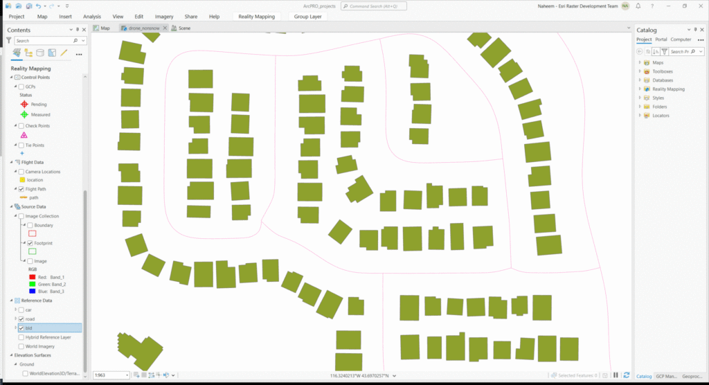
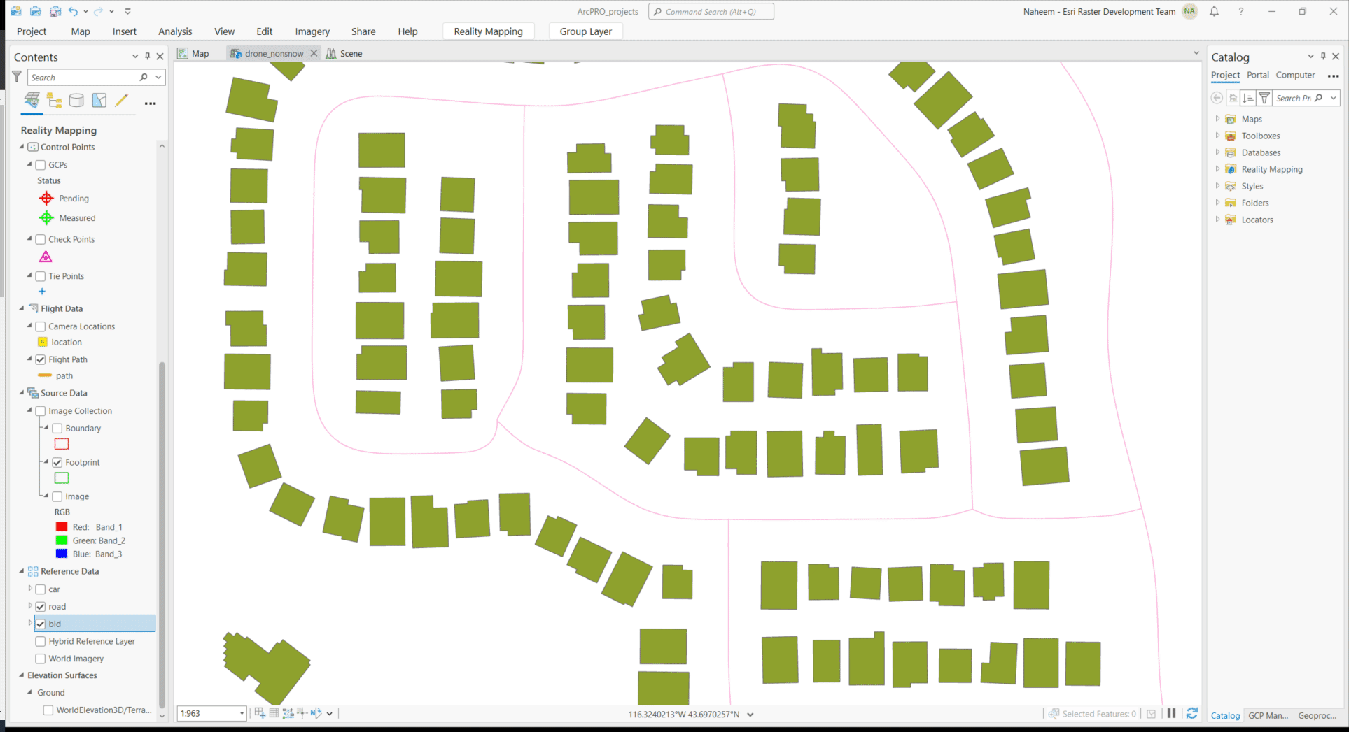
One of the remarkable outcomes was the production of a realistic-looking 3D mesh, as shown in the image above. The orthomosaic and elevation products also exhibited excellent quality. Moreover, ArcGIS PRO offers unique opportunities for further exploration and analysis beyond what is typically available in other photogrammetry software. For instance, advanced techniques like deep learning models can be employed to extract buildings, roads, and vehicles from the imagery. There are also appropriate tools for point cloud visualization, exploration, and classification so users can easily delve into detailed analysis and gain valuable insights.
Conclusion
This article showcase the utilization of ArcGIS PRO’s Reality Mapping feature as a comprehensive solution for photogrammetric projects. Using aerial photos captured over a neighborhood in Boise, Idaho, I demonstrated the seamless workflow from data preparation to processing and analysis. The resulting orthophotos, 3D models, and point cloud visualizations showcased the high-quality products and advanced capabilities offered by ArcGIS PRO. With its rich toolset and deep learning integration, ArcGIS PRO proves to be a valuable platform for extracting insights and conducting in-depth exploration of photogrammetric data.