Problem
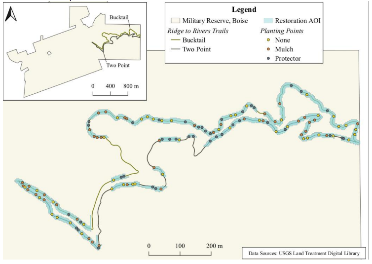
The Military Reserve in Boise, Idaho (Figure below) is a significant 737-acre natural area with diverse landscapes and ecosystems. Originally a military training ground, it now serves as a multi-purpose recreational area supporting outdoor activities and conservation efforts. The trails are getting wider as more people uses the park. To prevent trail widening and rehabilitate degraded ecosystems, about 200 seedlings were planted along the trail. The seedlings take years to grow and are subjected to trampling, erosion and harsh weather so need to be monitored regularly. Field surveys and manual data collection are labor-intensive, time-consuming, resource-intensive, and often limited in spatial coverage. However, Photogrammetry and LiDAR technology offer high-resolution imaging capabilities and a promising alternative for efficient and accurate seedling monitoring.
Lab Goal and Objectives
The goal of this lab is to explore the potential of using high-resolution Unmanned Aerial Vehicle (UAV) and LiDAR data for monitoring seedling survival. To achieve this goal, we will:
- Process UAV data acquired over a park (military reserve) in Boise and generate DEMs and orthomosaic.
- Perform raster analysis on the resulting products to generate other products such as vegetation height
- Explore the relationship between reflectance and plant status
- Explore LiDAR point cloud data, create DEMs and compare result with UAV products