Unoccupied Aerial Systems (UAS), commonly known as drones, have revolutionized environmental monitoring and ecological research. They offer a promising alternative to traditional methods, such as field surveys, for analyzing seedling survival and vegetation dynamics. In restoration projects, UAS technology helps determine optimal seedling placement and treatment for trail preservation and habitat restoration. UAS enables efficient and accurate monitoring over large areas, providing detailed terrain and spectral information at high resolution and affordable cost. In this article, I demonstrate how to monitor vegetation and seedling survival using drone images in ArcGIS Pro. I generate digital terrain and surface models, calculate vegetation height, and analyze reflectance values to identify variations associated with seedling status. This approach supports large-scale monitoring and informed management decisions..
Case Study: Trails restoration project in the city of Boise, Idaho
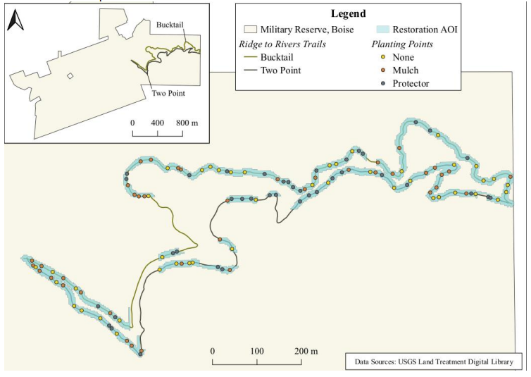
The Military Reserve in Boise, Idaho is a significant 737-acre natural area with diverse landscapes and ecosystems. Originally a military training ground, it now serves as a multi-purpose recreational area supporting outdoor activities and conservation efforts. It encompasses grasslands, sagebrush steppe, riparian areas, and foothill forests, harboring a wide range of plant and animal species. The reserve features an extensive trail network catering to hiking, trail running, mountain biking, and horseback riding, including the Two Point and Bucktail Trails, which are the focus of this study.
Data Acquisition
UAV data was acquired over the regions of the two trails in the military reserve as well as field surveys of the seedling’s survival status and treatment type. The UAV was flown at 110m height above the AGL at a steady speed of 12 m/s. It takes about 11min to cover the 11.8 Hectare area. A total of 102 images were acquired with more than 70% side and along and across track overlap. The UAV data was acquired in JPEG format with Phantom 4 Pro V2.0, a high-performance drone specifically designed for aerial imaging and data collection applications. 8 Ground Control Points (GCPs) uniformly distributed around the project domain were also acquired using high precision GPS equipment. 5 of these GCPs fall within the survey domain that we are processing for this project. Two of the GCPs are located around the east edge of the domain, two along the center and one along the west edge. Seedlings survey data was also acquired close in time with UAV data acquisition (plant_survey.csv). Data collected include survival status (survived or otherwise) and treatment type (Mulch, protected, none). A total of 154 seedling data was acquired. To extract imagery information for the seedling pixels, we also acquired high precision GPS data of the seedling locations (Topscon_points.csv).
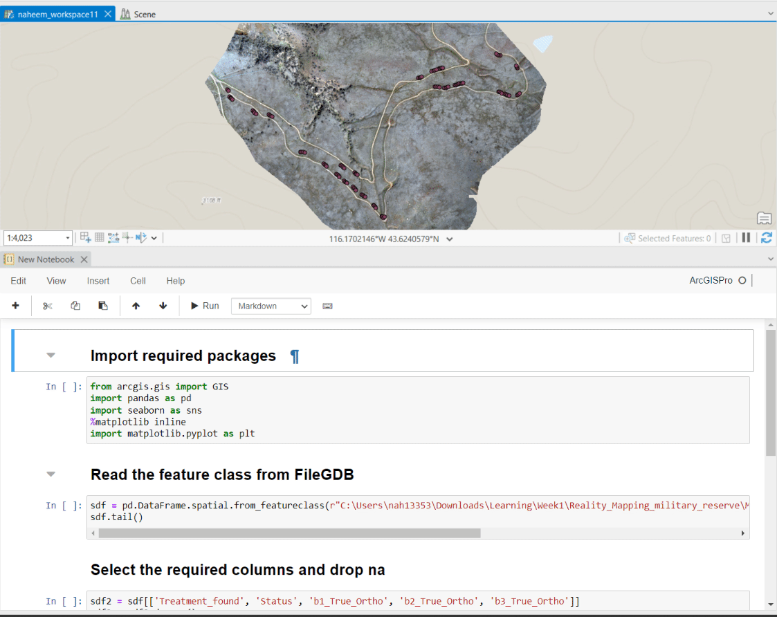
Ortho mapping in ArcGIS PRO
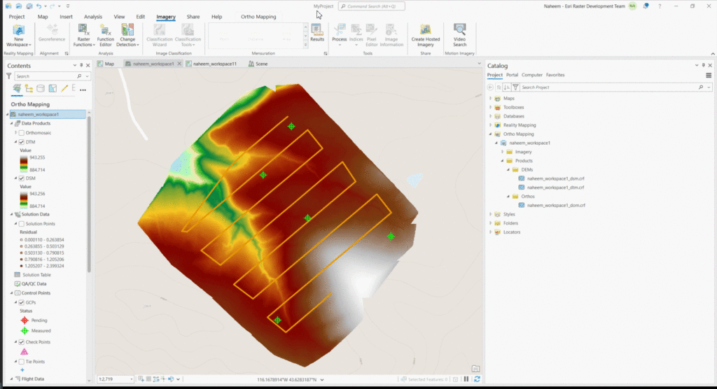
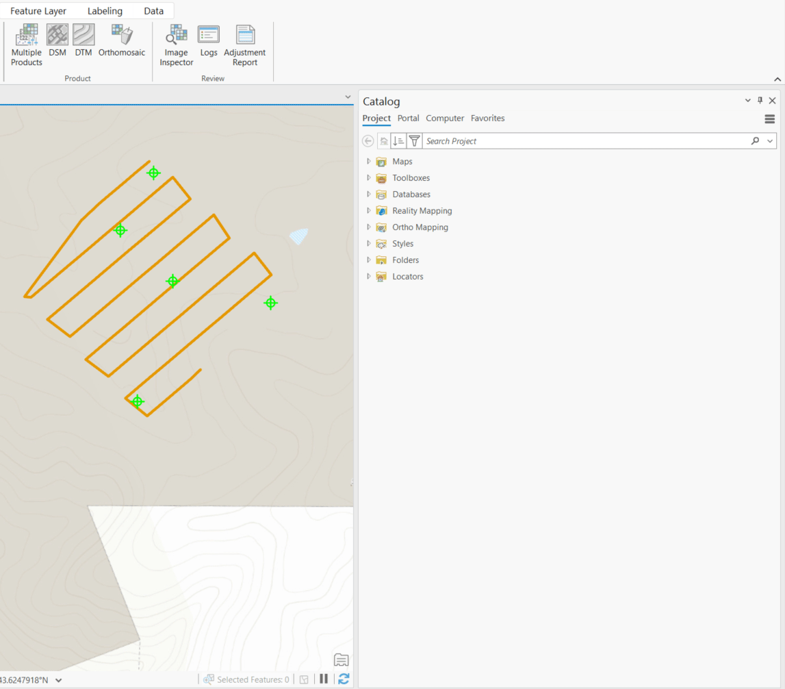
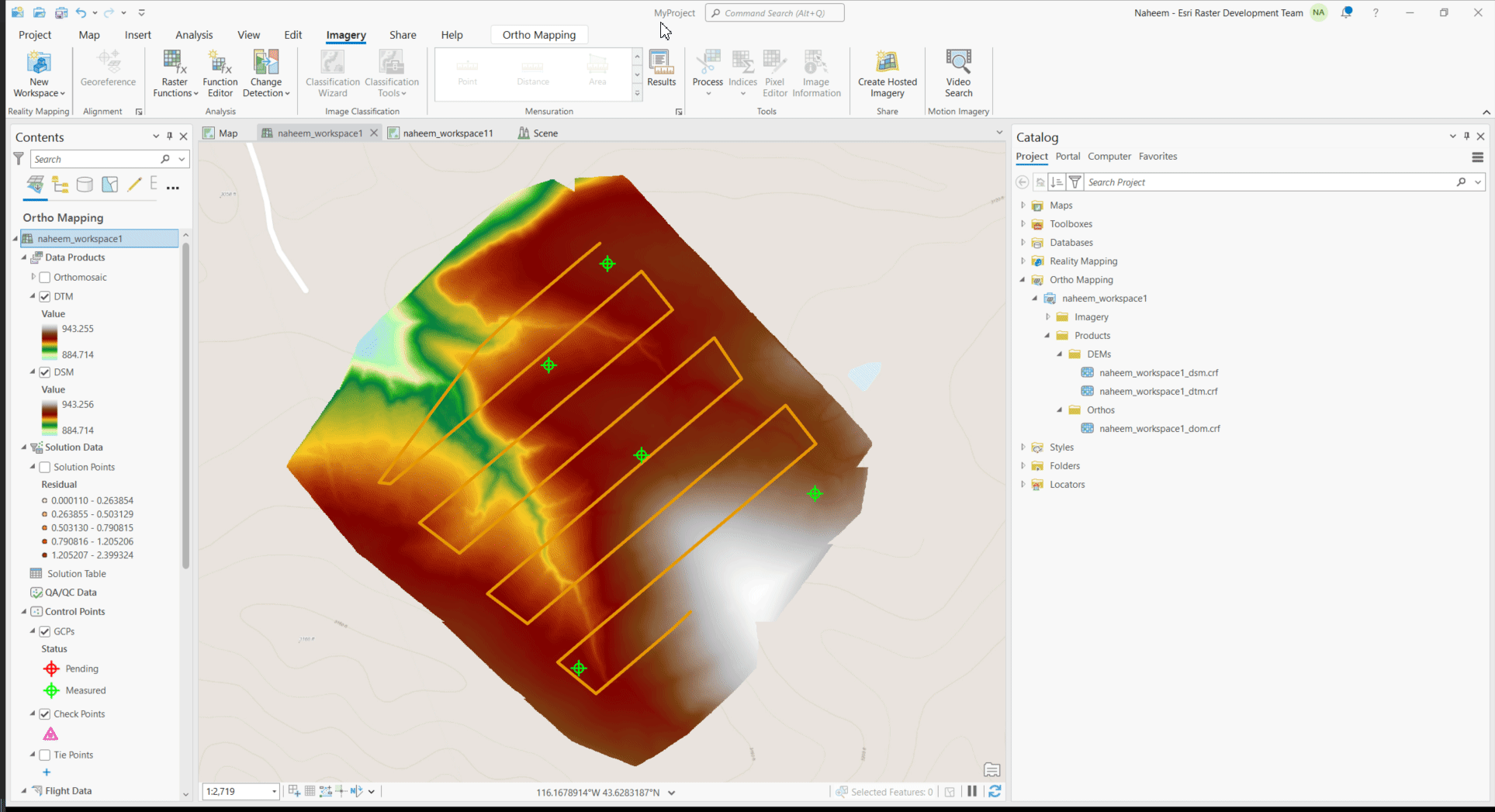
High-resolution digital elevation models (DEMs), including digital terrain models (DTMs) and digital surface models (DSMs), were generated from the UAV data using the ortho mapping functionality in ArcGIS Pro. Check this easy-to-follow tutorials for a comprehensive understanding of the processing workflow including workspace creation, block adjustment and product generation. Specifically, the product generation step is shown in the graphics below. Additionally, I have created a tutorial video that provides a detailed walkthrough of the reality mapping approach.
The key products generated are Orthomosaic, DTM and DSM. Orthophoto is a mosaiced image of the survey site but it has been geometrically corrected to remove the effects of perspective, terrain, and camera tilt. DSM is the elevation of the earth surface and includes natural and man-made features, encompassing buildings, trees, and the ground. In contrast, the DTM specifically focuses on the bare earth elevation, excluding above-ground elements like buildings and vegetation.
Computing the vegetation Height
Given the absence of man-made features, particularly buildings, within our study site, it is reasonable to deduce that the disparity between the digital surface model (DSM) and digital terrain model (DTM) represents the height of vegetation. Therefore, to obtain the vegetation height, DTM was subtracted from the DSM.
Canopy Height = DSM – DTM
Adding Plant Survey data
Using the add field option of ArcGIS PRO, the seedlings location which was acquired with Topcon instrument was added to the plant survey data. The csv table was then transformed into feature point layer using the XY table to points tool.
Extract Raster Values at Seedling Locations
Next, raster values for all sampled plants’ locations were extracted using Extract Multi Values to Points tool. This process added the three bands (rgb) of the orthomosaics at exact cell value of the seedling location as separate columns in the plants survey layer.
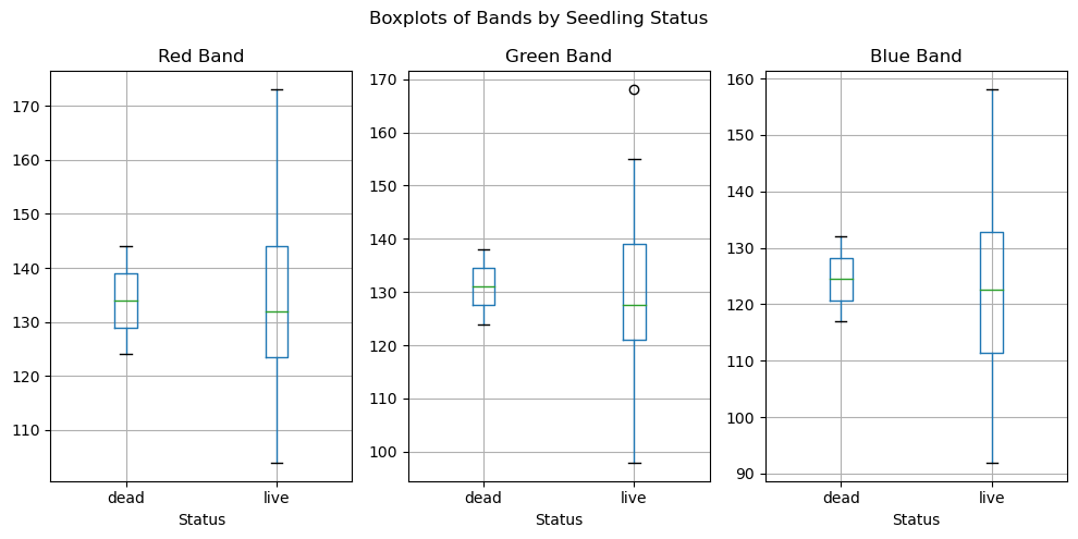
Reflectance Analysis based on Seedling Status.
Finally, a notebook was created in ArcGIS pro and the orthomosaic’s reflectance was plotted based on seedling status.
The boxplot provided a comprehensive representation of the variations in reflectance among different groups, shedding light on the potential relationships between seedling status and spectral characteristics. The mean reflectance values for dead seedlings is consistently higher than live seedlings across the red, green, and blue bands. However, distinguishing between dead and live plants solely based on RGB reflectance might be challenging due to significant reflectance variation within the live seedling group. Further advancements may be necessary, such as the inclusion of hyperspectral sensors or the utilization of a multispectral sensor capable of capturing data in the infrared region. By incorporating these enhancements, spectral indices can be calculated, offering deeper insights into the potential for identifying seedling survival and treatment types from UAV data.
Conclusion
Unmanned Aerial Vehicles (UAVs) present an unprecedented opportunity for efficient and regular monitoring of our changing environment at a high spatial and temporal resolution. This article demonstrates the use of ArcGIS Pro for ortho mapping, vegetation analysis, and seedling monitoring. First, I utilized the ortho mapping functionality in ArcGIS Pro to generate, high-resolution orthomosaic and digital elevation models (DEMs) from UAV data. The vegetation height was then computed by subtracting the DTM from the DSM, taking advantage of the absence of man-made features within the study site. Raster values for the sampled plant locations were extracted using the Extract Multi Values to Points tool. Further analysis and visualization was done in notebook within ArcGIS PRO to understand rgb reflectance based on seedling status. Visit this esri documentation page to learn more about reality mapping in ArcGIS PRO