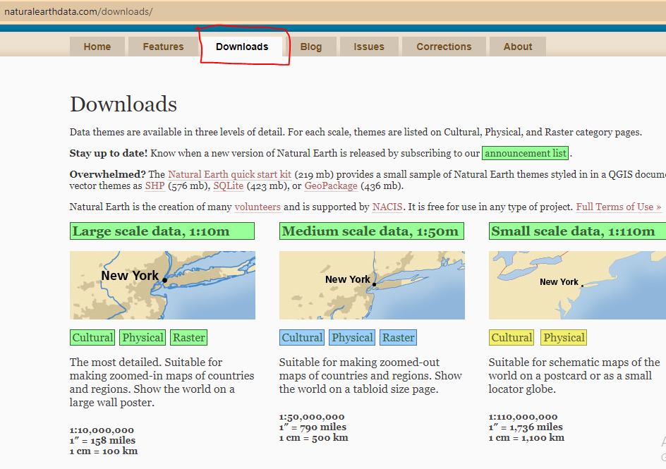
If you want to download free vector and raster data of administrative boundaries for your GIS work, check Natural Earth Data. The platform has its menu at the center with many options. You might wan to check the home, features, about and blog for a quick access to data, click the download menu.
There are three scales of data with the large scale having the highest resolution (1:10m). Three types of data are available- cultural, Physical and Raster. Cultural data are majorly administrative boundaries. Physical data contain datasets for delineating features such as coastline, ocean, rivers, lakes, glaciers etc. There are 7 types of Raster data which register precisely with the 10m vector data. Embedded raster content includes: land cover, shaded relief, ocean water, and drainages with lakes. All files include a TFW world file
Another platform for download vector data of the administrative boundary for United states is the United States Census Bureau.