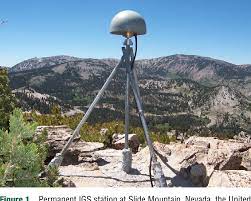
 Geodesy is the science of measuring the orientation, shape, size and gravity of the earth as well as the variation of these properties over time. Conventionally, these measurement is done using various surveying and astronomical equipment such as levelling, GPS, Tacheometers, theodolite and gravimeters. The figure to the right shows a GPS receiver at a permanent International Geodetic Station (IGS).
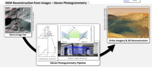
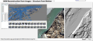
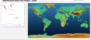
Development in imaging technologies in past decades have led to advancement in Geodesy. Imaging from land, airborne and spaceborne platforms are now being applied to measure the earth’s shape deformation. Various techniques for measuring earth shape include Stereo Photogrammetry, Structure from motion (SFM), Interferometry Synthetic Aperture Radar (InSAR), Shape from shading, Depth from Focus, Radar Clinometry.
The deformation and displacement of the earth can also be tracked from imaging using techniques such as InSAR, feature tracking and optical flow.